Applications for Macintosh
cdem
Stereonet3D
GeoKalk
SSPX
Trishear3D
Backstrip
Flex2D
By Nestor Cardozo (UiS) and Stuart Hardy (ICREA).
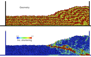
cdem is a macOS application for 2D discrete element modeling of geological structures and their deformation. cdem integrates pre-processing, processing, and post-processing (visualization) in a single application. To learn more about cdem, please check our paper in Geosphere and Stuart Hardy at LinkedIn.
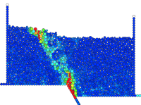
Different assemblies, properties, and boundary conditions can be chosen. The progress of the simulation can be observed in real time. When the run is complete, geometry, displacement, strain, or stress can be visualized and saved. cdem is a document-based application, multiple simulations can be run at the same time.
Out of courtesy, please let us know you have downloaded the program.
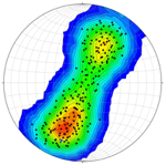
Stereonet3D plots lines and planes in spherical, equal angle or equal area, projections. The program can produce various types of plots such as scatter plots, great or small circles, arc segments, contours, rose diagrams, fault slip analysis (NEW), stereonets from any view direction, latitude-longitude data (e.g. coastlines), full screen 3D view, and Map view of data with lat-long information.
Stereonet3D can perform various operations, including calculating poles to planes, rotating planes and lines, constraining lines to lie on their planes, angle between lines or planes, cylindrical best fit, conical best fit, and mean vector. Data with lat-long information can be exported to Google Earth.
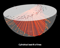
More information about Stereonet3D can be found in Cardozo and Allmendinger (2013). Stereonet3D runs on Mac OSX 10.9 or later. It is freely available on the Mac App Store.
To test the program's Map view and export to kml, here are two files with strike/dip data from the Big Elk anticline in SE Idaho, and locations in lat-long or UTM (right click to download and open with the program's File -> Load Dataset from txt menu).
Stereonet3D can perform various operations, including calculating poles to planes, rotating planes and lines, constraining lines to lie on their planes, angle between lines or planes, cylindrical best fit, conical best fit, and mean vector. Data with lat-long information can be exported to Google Earth.
To test the program's Map view and export to kml, here are two files with strike/dip data from the Big Elk anticline in SE Idaho, and locations in lat-long or UTM (right click to download and open with the program's File -> Load Dataset from txt menu).
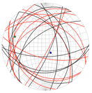
Structural geology deals to a great extent with the operation of vectors and tensors. GeoKalk (previously GeoCalc) is a calculator for vectors (lines and planes), and tensors (strain and stress).
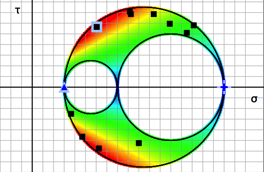
GeoKalk is a document based application. Multiple calculators can be opened and saved as independent documents. Multiple entries can be operated using tables. Entries can be load from and written to text files. Lines and planes can be visualized in a stereonet, and strain and stress in a Mohr circle. In 3D stress, the stereonet and Mohr circle can be coloured by slip tendency. Besides being a great tool to learn vectors and tensors and their application to geology and engineering, GeoKalk is a powerful tool to perform operations on thousands of vectors or tensors.
GeoKalk was made for geologists, but it can be used by anyone interested in vectors and tensors. GeoKalk runs on Mac OSX 10.9 or later. It is freely available on the Mac App Store.
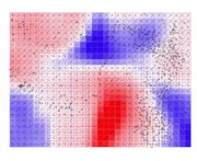
SSPX is a full fledged inverse modelling program to calculate best fitting strain tensors given displacement or velocity vectors in two or three dimensions. SSPX works equally well on small deformation problems such as computing strain rates from GPS data, or large deformation problems such as computing total strain in a highly deformed discrete element model (DEM).
SSPX can process single files, or batch process sequential files. Data with lat-long information (e.g. GPS stations) can be plotted on a Map/Satellite view. SSPX was made for geologists, but it can be used by anyone interested in computing strain/strain rate from displacement/velocity data.
More information about SSPX can be found in Cardozo and Allmendinger (2009). SSPX runs on Mac OSX 10.9 or later. It is freely available on the Mac App Store.
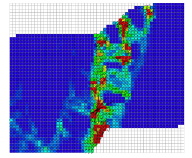
Here you can find some GPS and DEM files to test the program.
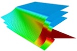
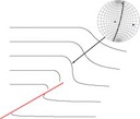
Trishear3D is a program to run 3D, forward trishear models. The program is based on algorithms by Cristallini and Allmendinger (2001), and Cristallini et al. (2004). Trishear3D can model the geometry and finite strain of fault propagation folds, fault bend folds, and lateral propagating faults. More information about Trishear3D can be found in Cardozo (2008).
Geometry and strain data can be visualized in a 3D plot which can be sliced along any orientation and queried for strain. Geometry and strain are also displayed in tables which can be exported. Trishear3D is a great tool to investigate the impact of temporal and spatial variations of fault parameters on the 3D geometry and strain field of fault related folds.
Trishear3D runs on Mac OSX 10.9 or later. The program is free for non-profit purposes (for consulting please contact me).
version 7.1, August 9, 2021
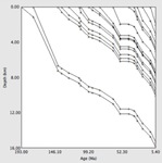
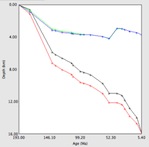
The subsidence of a sedimentary basin is due to: tectonic subsidence, water and sediment loading, and sediment compaction. These three components can be estimated from a stratigraphic section using "backstripping" (Allen and Allen, 1990). This removes from each sedimentary layer the effects of sediment compaction and water and sediment loading; thus extracting from the section the tectonic subsidence curve.
Backstrip (previously OSXBackstrip) is a program to perform "1D Airy backstripping with exponential porosity reduction". Stratigraphic units can be input in a table, and backstripping and tectonic subsidence plots and tables can be produced. Plots can be edited or saved for publication. Multiple documents (stratigraphic sections) can be backstripped and compared.
Backstrip runs on Mac OSX 10.9 or later. The program is free for non-profit purposes (for consulting please contact me).
version 5.3, August 15, 2022
Backstrip is an Intel Application
On M1 Macs, it runs under Rosetta
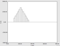
The displacement profile of the surface of the earth under crustal loads (e.g. mountain chains) can be well reproduced by an elastic flexural model. In this model, the uppermost layer of the earth responds to crustal loads as an elastic beam floating in a weaker, fluid-like foundation (i.e. the astenospheric mantle, Turcotte and Schubert, 1982).
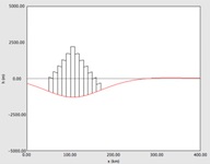
Flex2D (previously OSXFlex2D) implements the elastic flexural model in 2D for a plate of constant or variable elastic thickness. Crustal loads can be entered and plotted, and the profile of deformation produced by these loads can be computed and visualized in plots and tables. Plots can be edited or saved for publications. Multiple load profiles can be computed and compared.
Flex2D runs on Mac OSX 10.9 or later. The program is free for non-profit purposes (for consulting please contact me).
version 5.2, August 15, 2022
Flex2D is an Intel Application
On M1 Macs, it runs under Rosetta